
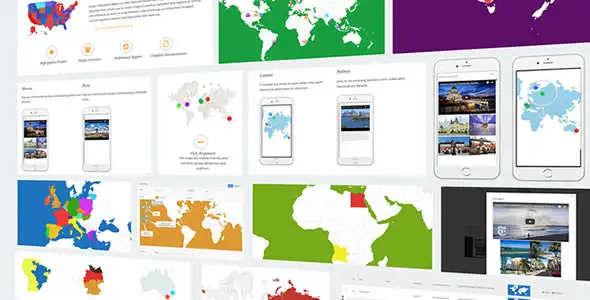
Super Interactive Maps is a comprehensive WordPress plugin designed to help you create stunning, interactive maps directly on your website. Built with the Google Geochart API, this plugin gives you the power to display maps of countries, continents, and regions with rich interactivity that engages visitors and delivers information in a visually compelling way.
Whether you need to showcase global office locations, create an informative store locator, or embed a custom map in a blog post, this plugin provides a flexible and user-friendly solution. It is fully responsive, works across all devices and browsers, and integrates seamlessly with the latest version of WordPress.
This plugin includes an extensive library of vector maps covering:
By adding interactive maps to your WordPress site, you can significantly enhance user engagement and deliver geographic information in a way that is both intuitive and visually appealing. Visitors can explore locations, discover points of interest, and access rich content through tooltips and pop-ups — all without leaving your page.
The plugin’s powerful admin interface makes it easy to create and manage maps, even if you have no technical background. The autocomplete search and drag-and-drop marker features streamline the process of adding precise locations, while the extensive customization options ensure your maps match your site’s design and branding.
Super Interactive Maps stands out with its combination of breadth and flexibility. With over 300 maps covering every country in the world, you will not need additional plugins or add-ons to display the geographic data your audience needs. The plugin’s responsive design ensures your maps look professional on every device, while the extensive customization options give you full control over how your maps appear and behave.
The GPL license means you can use this plugin on unlimited domains, making it an excellent value for agencies and developers managing multiple client sites. Lifetime updates ensure your plugin stays compatible with future WordPress releases.
The plugin includes over 300 vector maps covering all 195 countries in the world, every continent and subcontinent, and region-specific breakdowns for individual countries including the USA divided by state, region, and city.
Yes. All maps are fully responsive and work across all devices and browsers, including desktops, tablets, and smartphones.
The plugin uses a GPL license with unlimited domain usage, meaning you can install and use it on as many websites as you need.
Yes. You can customize background colors, border styles and colors, foreground colors, cursor colors, region colors, marker colors and sizes, text label colors, custom markers, and map width and height.
You can choose from three display styles: region-based highlighting, bullet markers, and text labels. You can also add interactive tooltips, lightbox pop-ups, and URL links to map elements.
Super Interactive Maps is a powerful, versatile WordPress plugin that makes it easy to create beautiful, interactive maps for any type of website. With 300+ built-in maps, full customization options, responsive design, and a user-friendly admin interface, it provides everything you need to engage visitors with compelling geographic content. The GPL license with unlimited domain usage and lifetime updates makes it a smart investment for individual site owners, agencies, and developers alike.
Super Interactive Maps is a WordPress plugin that lets you create stunning interactive SVG and vector maps with 300+ built-in maps covering all 195 countries worldwide.300+ vector maps including world, continent, and country-level detailFully responsive design compatible with all devices and browsersInteractive tooltips, lightbox pop-ups, and custom markersAutocomplete location search and drag-and-drop marker placementFull visual customization: colors, styles, zoom, pan, and moreGPL license with unlimited domain usage and lifetime updates
From multipurpose themes to niche templates